Router planner has been built to integrate the benefits of a rich database, containing thousands of camper services, park areas etc. with a powerful map system (like the Here Maps) in order to build a route planner who is able to take into consideration veichle dimension.
Route Planner is, obviously, connected to the Miniservices infrastructure, because thanks to this set of REST API that it is able to access to the buonevacanze.org database.
Starting from Jan 2020 the website Buonevacanze.org, has been dedicated to people passionate for RV and open air activities. It is, so, normal that the Route planner has been completelly merged with this web site.
NOTE: Buonevacanze.org web site is currently in Italian and contains information only for European sites.
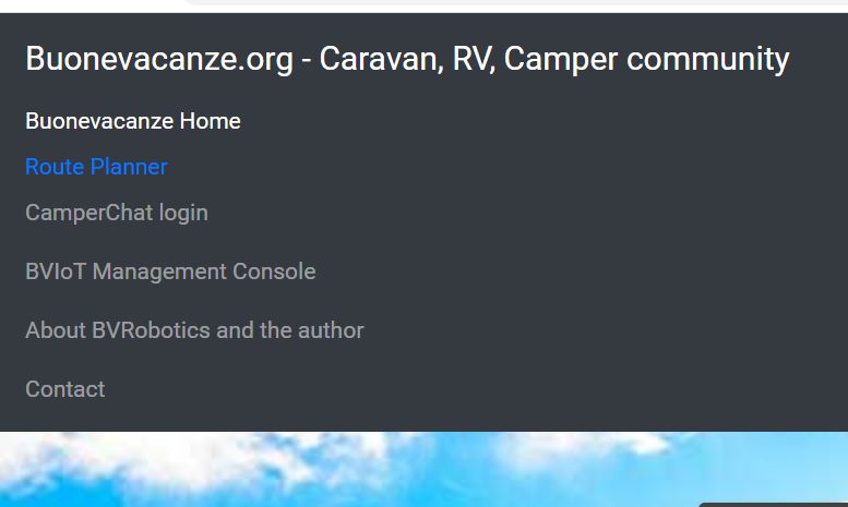
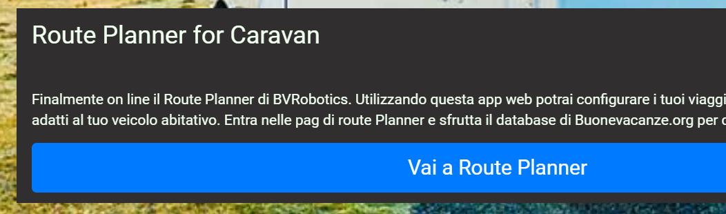
From the main page of Buonevacanze.org there are two ways to access the route planner web application:
The first one is selecting the menu at the top.
The second option is to use the card displayed in the middle with the big button to access directly the "Route Planner" module
In both cases you will see that the link at the bottom will switch to https and the connection will be routed to "www.buonevacanze.org/RVPlanner".
Note that this link is not a valid HTTP link because it is an angoular routing option (it will return 404 error when selected manually), so do not bookmark it into your web browser options.
If you want to bookmark it, I prepeared a valid web url that you can use to access it directly:
https://www.buonevacanze.org?uName=RVPlanner
This link can be stored in your favourites and can be used to access the route planner directly from your mobile devices or from your arduino modules
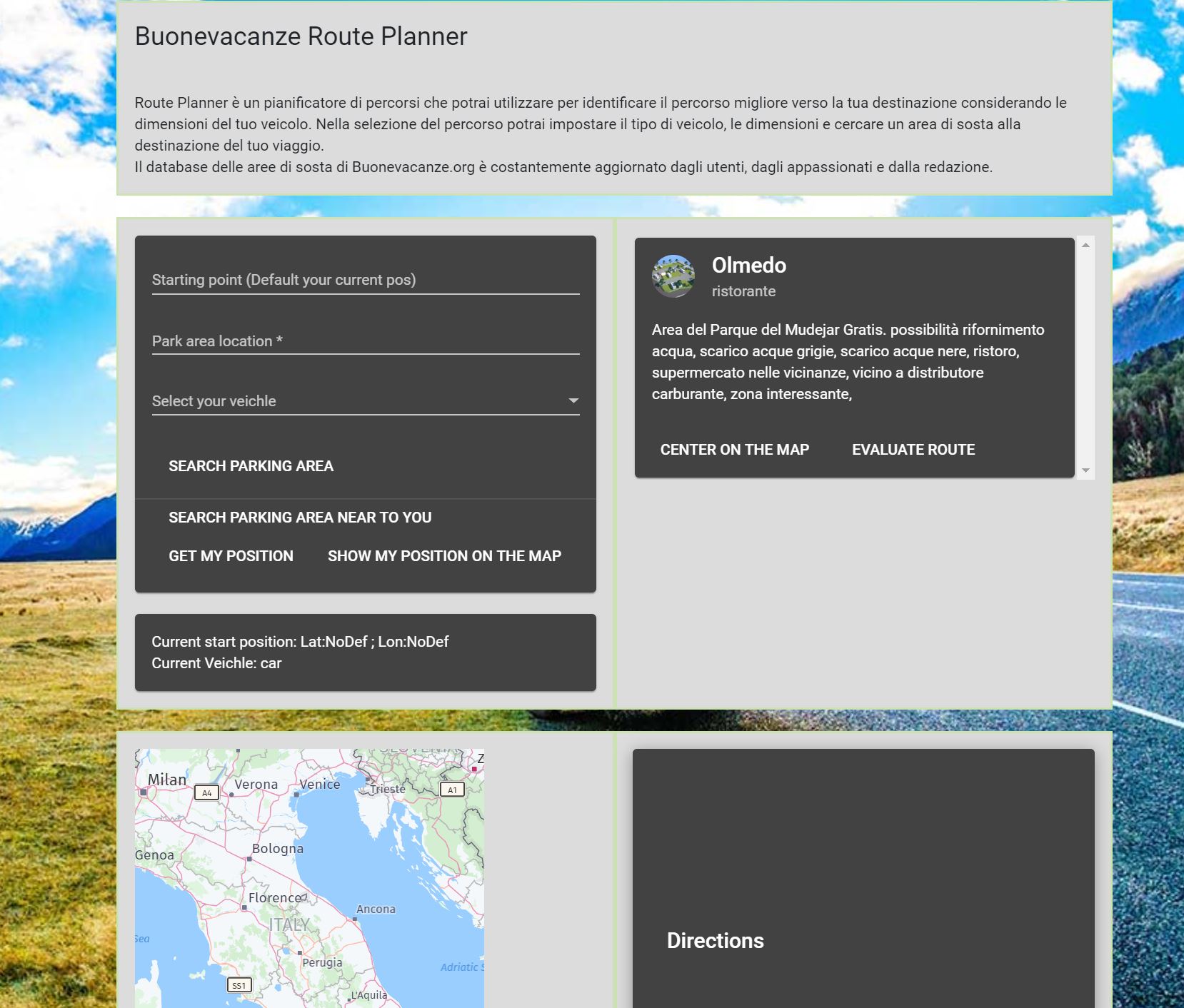 When you open for the first time the page, the system, selects a random area to show in the top right frame. The Map just displays the Italy map and the directions list is completelly empty.
In the top left corner you will see the main control block. From here you are able (not all features are yet implemented but I will complete it very soon) to: 1) Enter a specific start location (As default the system retrieves, when requested, your current coordinates)
2) Search for a destination RV area or park area
3) Select your veichle
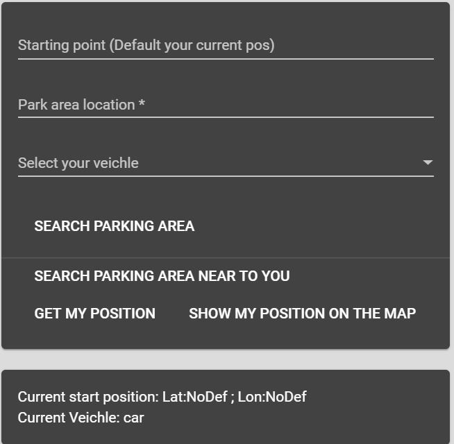 The 3rd block is the most important one. You can select 3 options:
By Car
By foot
By truck or RV
. Selecting "by RV" the system, automatically, when calculating a route, will take care of bigger dimension for your veichle (more than 7 mt long, 3 meter height and 2,50 mt width). It means that the system will use bigger streets even if the duration will be higher
If you want to search for an RV related parking area then enter the location you want to visit in the second text box named "Park area location" and select the button: "Search parking area". The system will interrogate the BVRobotics database and will retrieve all the parking areas located in the specific location.
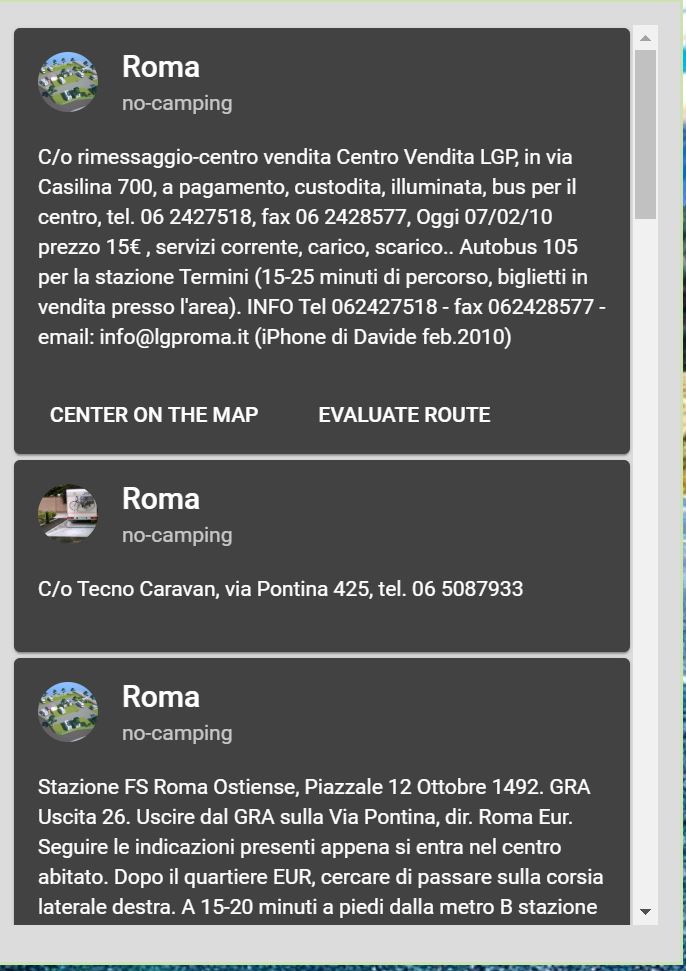
The result will be displayed in the top right box. If more than one result is available you will have a scroll bar to scroll the content of the card area.
Each area will be displayed as a block. It could happen that an area doesn't have geographical coordinates in the database. For this reason the buttons "CENTER ON THE MAP" and "EVALUATE ROUTE" could not be showed for that specific area.
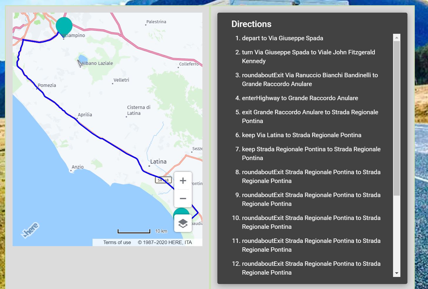
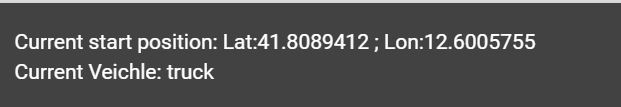
Once a set of parking areas is retrieved, you will see the map positioned on the location you requested and different placeholders representing the areas found. Moving on each placeholder with the mouse, you can see the relation between the area and the map. Before to evaluate a route to reach the specific area, you need to select the origin of your trip. In order to do this, you will need to enter a start location in the main control panel or push the "GET MY POSITION" button. Once your position has been retrieved you will be able to view your position on the map (pressing the button: "SHOW MY POSITION ON THE MAP"), but also to view the latitude and longitude values related to your position. As you can see, in the second picture I selected also my veichle that is an RV and this is reflected in the view panel.
Once a set of parking areas is retrieved, you will see the map positioned on the location you requested and different placeholders representing the areas found. Moving on each placeholder with the mouse, you can see the relation between the area and the map. Before to evaluate a route to reach the specific area, you need to select the origin of your trip. In order to do this, you will need to enter a start location in the main control panel or push the "GET MY POSITION" button. Once your position has been retrieved you will be able to view your position on the map (pressing the button: "SHOW MY POSITION ON THE MAP"), but also to view the latitude and longitude values related to your position. As you can see, in the second picture I selected also my veichle that is an RV and this is reflected in the view panel.
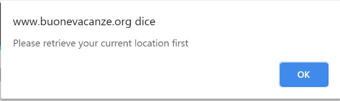
If you forget to enter the origin of your route, you will receive an error message immediatelly when you press the button: "EVALUATE ROUTE".
As in any other map you will be able to zoom and move the map to display more or different details.
One of the advantages to use HereMap APIs is that it allows you also to have the satellite view that, in many occasions, is very usefull to see places and real distances between nav points.